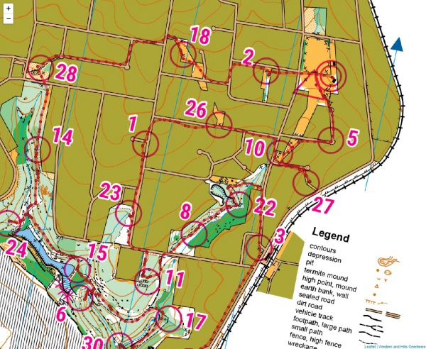
Have you ever wanted to overlay your GPS route on top of an orienteering map? This article explains how it can be done.
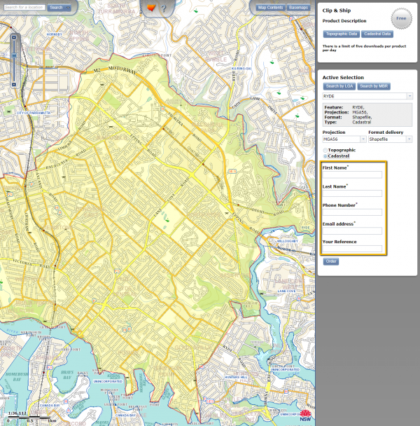
This article shows where to locate cadastral data for any location in NSW, and how to simplify it for use in street orienteering maps.
© 2026 ant.burnett.com.au — Powered by WordPress
Theme by Anders Noren — Up ↑