
The geodatabase is the native data storage format for ArcGIS. It offers many advantages for modeling, analyzing, managing, and maintaining GIS data.
Learning Objectives
- Describe the components of the geodatabase.
- Create geodatabase schema.
- Design and create a geodatabase.
Advantages of using a geodatabase
| Feature | Description |
|---|---|
| Centralised repository | All data is stored in the same database, as opposed to in many separate files. |
| Scalable data model | As your GIS needs increase, you can migrate data from one geodatabase to an upgraded format that allows for more users and editors. |
| Increased data integrity | You can create spatial and attribute behaviours to facilitate editing, help eliminate data entry errors, and maintain spatial and attribute relationships between your data. |
| Support for imagery | Mosaic datasets in the geodatabase allow you to manage multiple images as one. |
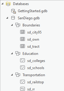
Types of geodatabase
- File Geodatabase:
- a collection of GIS datasets stored in a file system folder.
- work across operating systems and can store individual datasets up to 1 terabyte (TB) in size by default. The size limit can be increased with keywords to 256 TB.
- support multiple people editing different feature classes or tables at the same time.
- based on SQL Server Express (.mdf)
- Enterprise geodatabase:
- support versioning and replication.
- require a database management system (DBMS), such as DB2, Informix, Microsoft SQL Server, Oracle, or PostgreSQL.
- typically found in larger organizations.
- support multiple users viewing and editing the GIS database at the same time.
Mosaic Datasets
A mosaic dataset is a data model within a geodatabase that is used to store, manage, view, and query large collections of raster data. It can be a heterogeneous collection of raster datasets (individual images) with multiple formats, sources, data types, resolutions, number of bands, pixel depths, file sizes, and coordinate systems.

Certificate

Recent Comments